


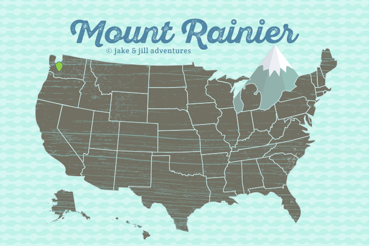
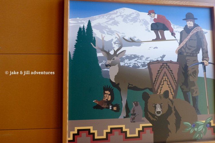
A Quick Drive Through Mt. Rainier National Park
The National Park Circuit continues on down the Olympic Peninsula to the massive and active volcano standing over 14,000 feet above the horizon known as Mount Rainier.
I think I have said this before, but Jake and I are not planners. That said, we didn’t think about the fact that our visit to this wildly popular park would fall on a holiday weekend and that quite possibly, we may not be able to find accommodation. Our naiveté is what made us believe that if we arrived early enough, we would be able to find “walk-up” camping spots. We figured this would be a perfect basecamp to explore the sub-alpine wildflower meadows that ring this icy volcano or the ancient forests cloaking her lower slopes. Or quite possibly scaling the massive volcanic beast in all her glory. It wouldn’t be our first!
It was hard to get moving so early, 5AM came round too soon. That means, if our calculations hold, we should arrive to Mt. Rainier National Park in just about 4 hours, which should be early enough to snag a camp. The drive was gorgeous, following the Olympic peninsula’s thick greenery to the lower slopes of Rainier’s forests.
Our hope was to go to the closest campgrounds, which said they had walk-up sites available. The first being Cougar Camp, we were excited to see empty spaces, but as we drove on, we spotted reserved signs on the camp posts. On and on we drove and kept spotting those stupid signs. I thought these were walkup-only, yet somehow all of them were reserved. What the heck!!?
We stopped at the front to speak to a park ranger, who informed us that this campground, like all the others within the park, are fully booked, despite the website saying that there were several walk-up camp sites available. Apparently not, and therefor we had to move along. Jake was furious and just wanted to leave the park altogether, but I insisted that we at least take a trip up to viewpoint of Mt. Rainier and the Visitor Center.
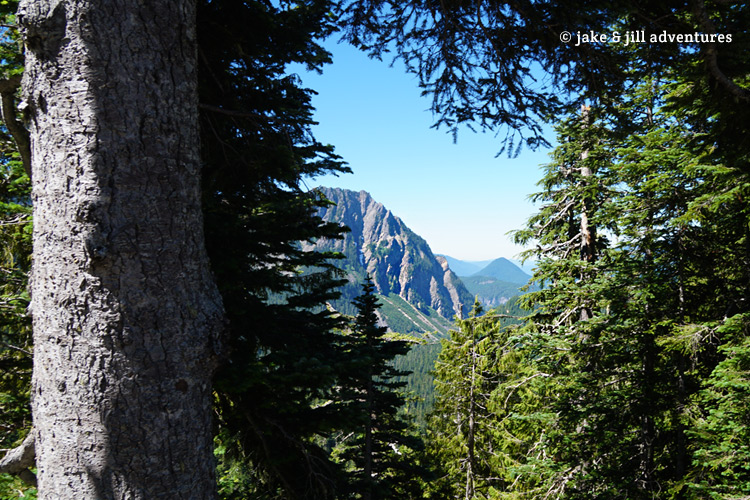
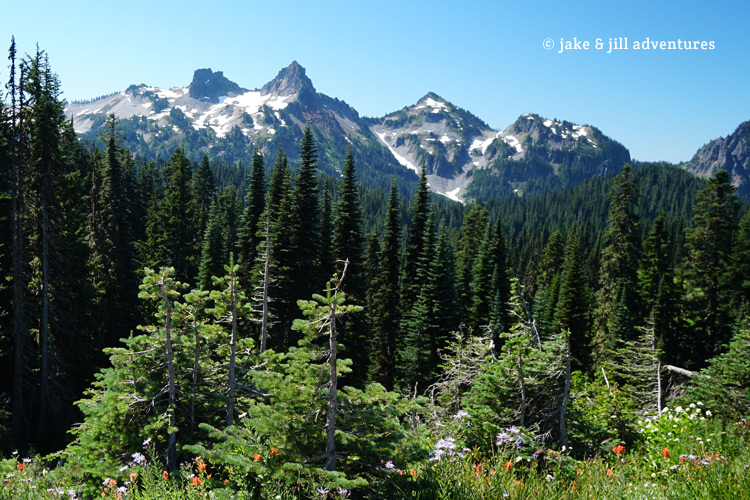
Though not too far, the road was extremely winding and had a lot of massive construction delays which only further added to our annoyance. The visitor center was at the very top, from which you can hike up to Camp Muir, a hike that we planned to undertake if we can find camping. But since it doesn’t look like this is an option, we aren’t exactly sure what to do.
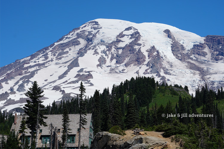
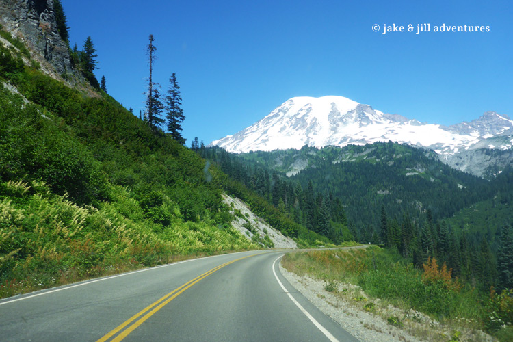
By the time we reached the top (nearly an hour later) the parking spaces were all full. Jake didn’t care much and parked in the hotel’s parking lot, since we are only going to spend a little bit of time here. The place was mobbed with visitors, and you could see the crisp, snow-covered towering peak above. I was so eager to go for a hike, but it just wasn’t in our cards for this journey. We spent some time reading all the placards and dioramas of the visitor center before calling it good.
What do we do now?
This is the eternal question, it seems, from this road trip. We didn’t plan anything beyond Mt. Rainier nor had we any clue for where to go next, since we hadn’t spent time looking for land. It is really difficult to choose which direction to go. West or South? West takes us back through Washington and South would be through Oregon. As we are already so far to the west, we considered exploring some parts of Northwest Oregon before going too far South.
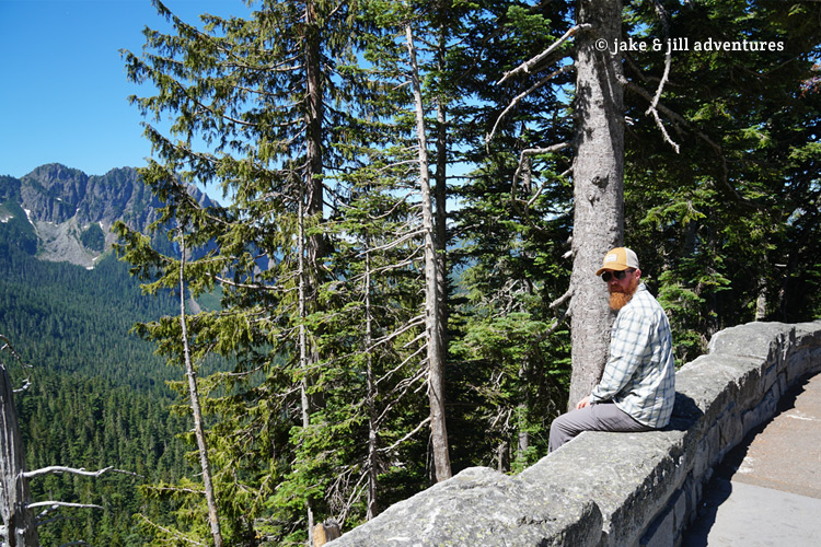
We opted to take a drive down the other side of the scenic road, stopping frequently at pullouts along the way. I made us some pepperoni wraps for lunch, where we sat on a particularly beautiful overlook to ponder our next move. Jake pulled out the map and we contemplated where to go. Turns out that we didn’t have to make a decision, rather the road made it for us. Since there is only one way out of here (unless we turn around), we opted to follow this road’s winding path, which happened to be going south and west.
Though lovely, we were both frazzled by this change in plans. I kept trying to find state parks that we might be able to find camping, but all of those that we passed were already fully booked. UGH!!!! After our second failed attempt, we were both pretty much over this nonsense, and so we pushed on down Highway 5, south.
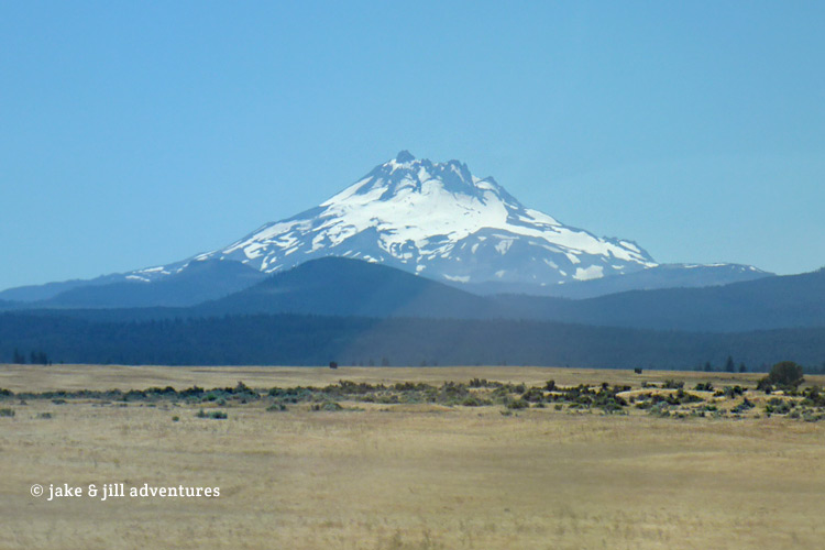
I could see Mt. St. Helen’s and Mt. Hood in the far distance, both would be amazing volcano’s to explore. However there was no camping anywhere near, which meant that we have to look elsewhere. I pulled out the phone in hopes that we would have a signal from which I could search the internet for some form of accommodation. It took awhile, but finally found connection and I did a quick search for the cheapest and closest hotel that I could find and booked it for the night. It was only 30 more minutes to Kelso, Washington and will serve just fine for us.
The hotel was really nice considering the cheap price. It was centrally located within a shopping mall, making it easy to stock up on food and supplies. It also doesn’t hurt that there’s a big, comfy bed, air conditioning and a hot shower. From here, we had to formulate a plan. Jake worked on land-hunting while I searched for places to stay. Bootleg camping was nearly impossible to find, hotels were very pricey.
Jake found some potential land in several areas not too far from here; Prineville, La Pine, Culver, Christmas Valley and Enterprise, Oregon. With some semblance of a plan, I was able to find a camping website from which I could book us 4 nights; 2 in Cove Palisades State Park and 2 in Wallowa Lake State Park. Each is centrally located to the land that Jake scouted and available on the dates we selected, thank God!
I think we both feel like we need to make another trip to Mt. Rainier and maybe even a summit attempt. And despite a very long and disappointing day, we were happy to see the manifestation of this new plan and our hopes began to grow again.


The hike to Camp Muir is really hard, but well worth it. Best to do it in summer months 🙂