


Crozon Peninsula
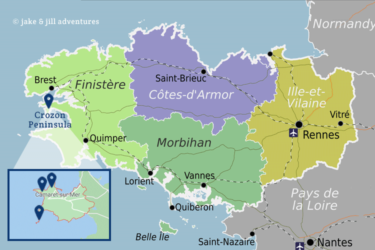
A central feature of Brittany’s northwestern coast consists of craggy rocks that stretch into the blue Atlantic. Villages seem deserted, made of stone and lined with blue and purple hydrangeas dot the roadway that we took from our Kermorvan chalet. Our plan was loose, as is the norm for this motley crew; Vauban Tower, Saint Thegonnec, Camaret sur Mer, Lagatljar Alignments, and at least three different Ponte de something’s…
The drive was longer than anticipated and thus left a bit later; 1030AM. Jake packed us a hefty amount of food and beverage that should tide us over. The first portion of the drive was familiar, and then we encountered something we had yet to encounter in France…A traffic jam. Sure enough we are in full swing of holidaymakers, a long weekend and sunny forecast ahead. So its not surprising.
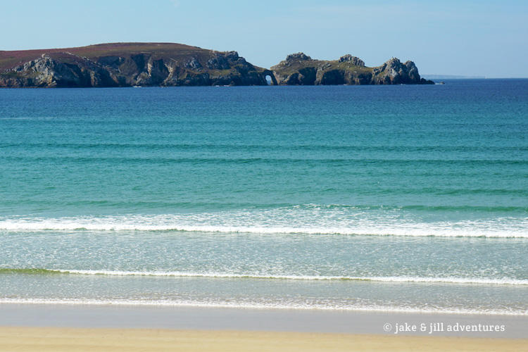
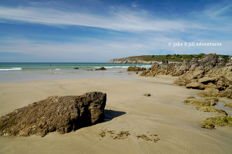
As the road narrowed and the cars in front of us were moving at a snail’s pace, we decided to pull off at the first glimpse of water and a sandy carpark. Both of us needed to stretch our legs. We only had to walk a few meters towards the coast and were stunned by the gorgeous view in front of us. A vast and perfect blue beach dotted with limestone rocks were calling to us.
For such a beautiful spot, I was surprised that there were no signs of hotels, attractions or anything other than this remote beach. I could only imagine some mega-hotel chain chomping at the bit to get their greedy paws into the perfection that lay ahead of us. Thankfully there was no such thing.
We were pleased by the warm weather, which we haven’t seen in a long time. There were only a few other people out here so we felt like we had the beach to ourselves. I wish I thought to pack swimsuits, today would have been the perfect beach day. Instead we walked along the water hunting for shells and tidepools with little coral and crab.
It was just the break we needed, but not yet our final destination. We hopped back in the car and motored along with the line of traffic. I noticed how odd it was that we haven’t seen any traffic lights since our drive this morning and in fact, there are no stop signs or left-hand turns. Its all roundabouts, which is why its such slow going. I passed the time spotting French words that I couldn’t remember and took time to look them up…One that keeps popping up: “A Vendre” which means “For Sale”. It seems like all of Brittany is for sale because we seen these signs everywhere from massive chalets to tiny little square sheds. Another is “Rappel” which we see on all the road signs, which means “Reminder”. Of course there are several that we see all the time; Boulangerie, Creperie, Moules Frites…FOOD.
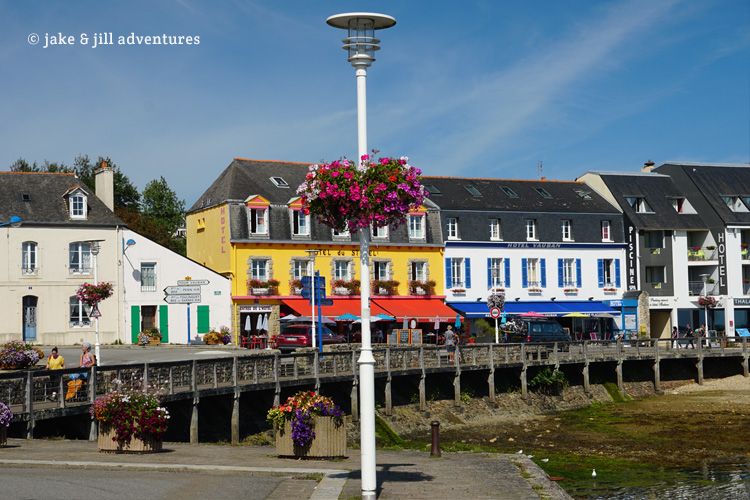
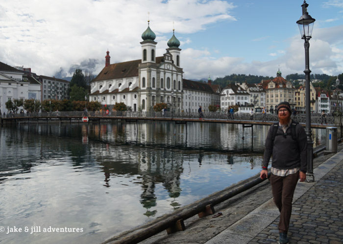
Finally we turned down a road that ended at Camaret Sur Mer. The line of cars dispersed some, but Jake pulled into the first spot that we found, just in case. From here we walked along the jetty that runs parallel to a colorful town. Its easy to spot Vauban Tower, pink hued against the blue of the ocean. Its a World Heritage Site and one of our destinations.
If we were on a dinghy, we could probably get over there in about a minutes, but the bay is wide, so we had to walk a good 30 minutes to get around to the other side. This is clearly a fishing port, or was, with charming and colorful buildings and large bay full of boats.
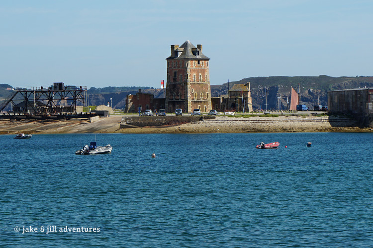
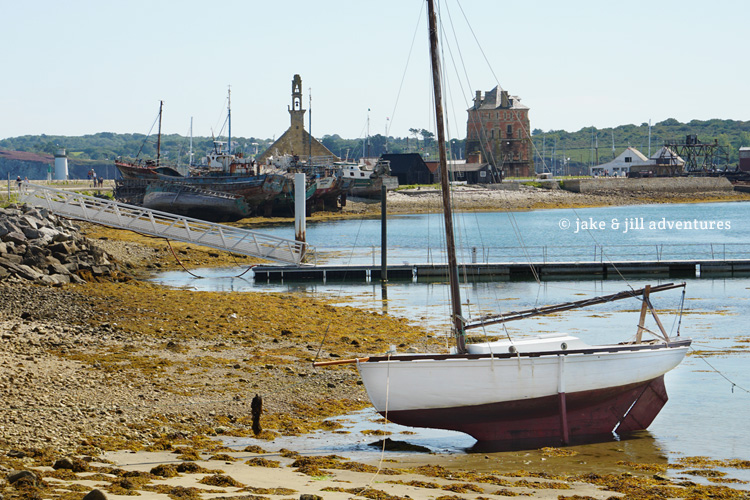
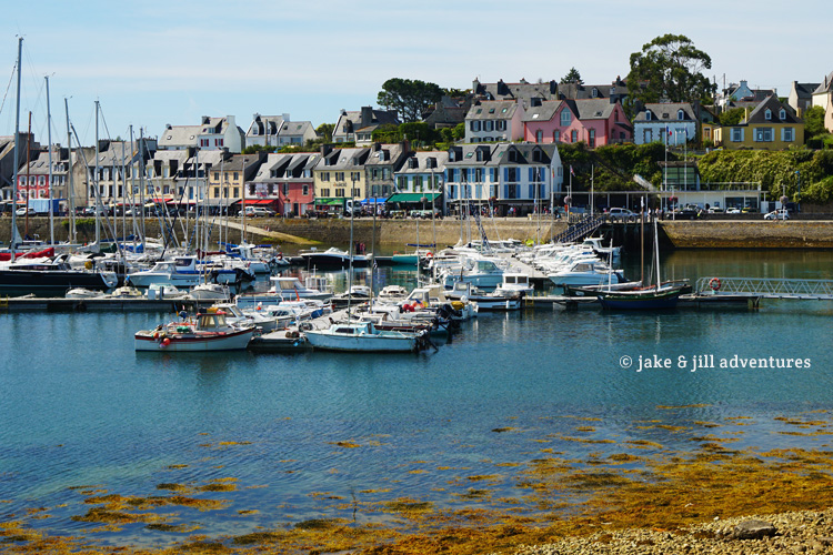
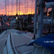
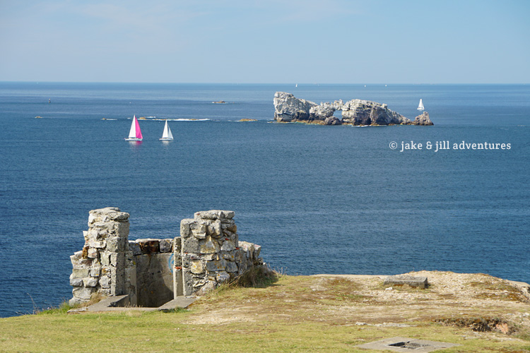
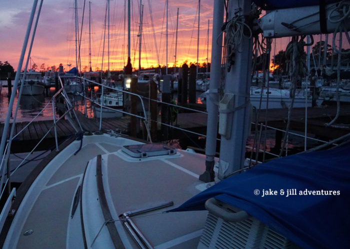
On the ocean-side opposite the village is a larger bay where sailing and cruising vessels were nestled at anchor. It has me a bit nostalgic for the cruising life again and I imagined our Bosco boat would fit nicely out here in this perfect haven on the French coast.
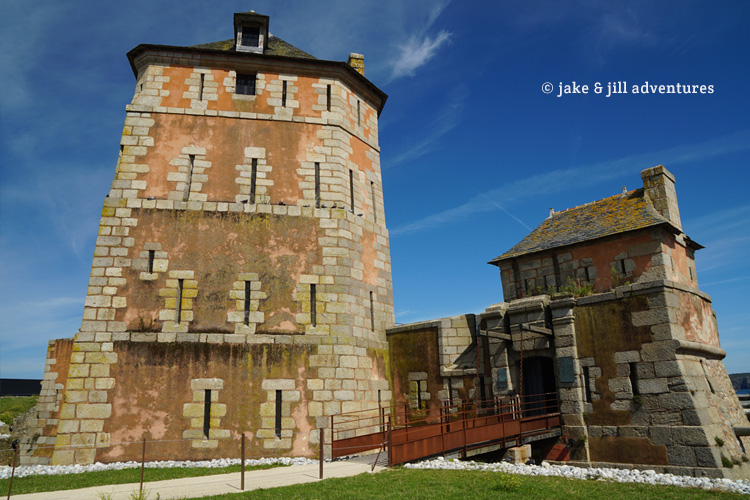
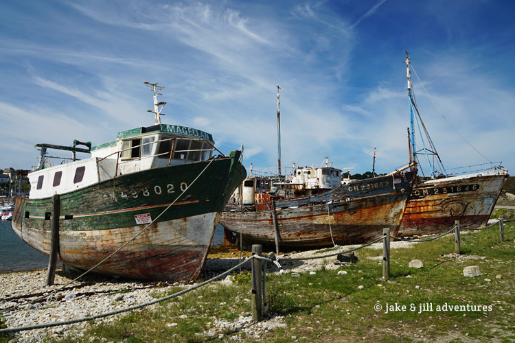
The Tour Vauban (Vauban Tower) was built in 1689 for the purpose of defense from entrance into Brest, a major French military port. Its much smaller than I imagined, though it does have a moat and is only accessible from a small gatehouse and drawbridge. Today its guarding nothing more than some decaying fishing boats, which speaks a bit about the history of this village.
We spotted another of those rare and illusive sights a public toilet, in FRANCE. And not just public, but Free, which is almost unheard of. And in our experience, the bathrooms haven’t been the most clean, but this one was more like those of New Zealand, ultra-modern and free from grime. We joke that the French will poop anywhere that is Free (a bush, a tree, the side of the road, in plain site of anyone). So we were elated to do our business behind closed doors. 😉
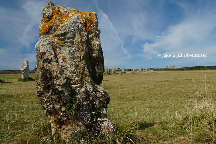
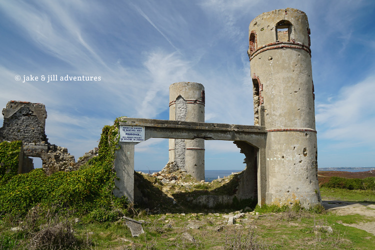
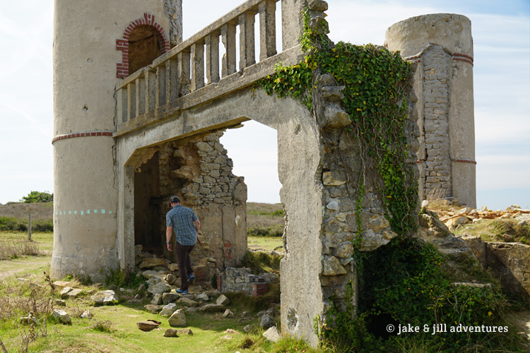
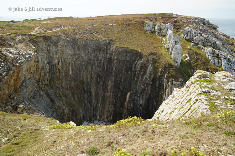
Down the road, less than a kilometer are the Lagatjar Alignments. These are 143 standing stones that are arranged on a field at the edge of the cliffs. There must be some significance to these, but nobody seems to know what. Maybe to ward off evil spirits or for some religious purpose. Perhaps its similar to Stonehenge or Avebury. In the distance of the stones was a large crumbling tower that piqued my curiosity. There was a hidden walkway not too far and we followed it up to what looked like an old crumbling manor house. It was set on top of the most gorgeous overlook lined with rocky cliffs, a massive beach, in the distance sailboats and small jutting rocks could be seen. It was absolutely picture-perfect.
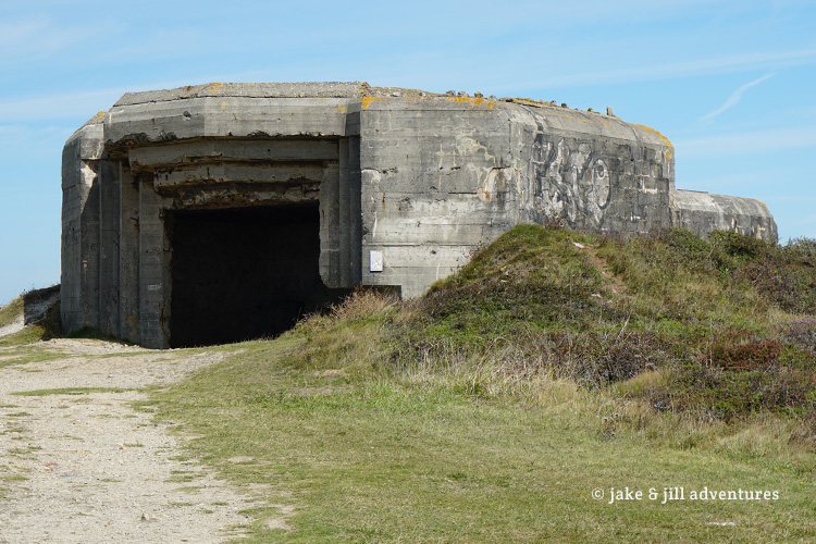
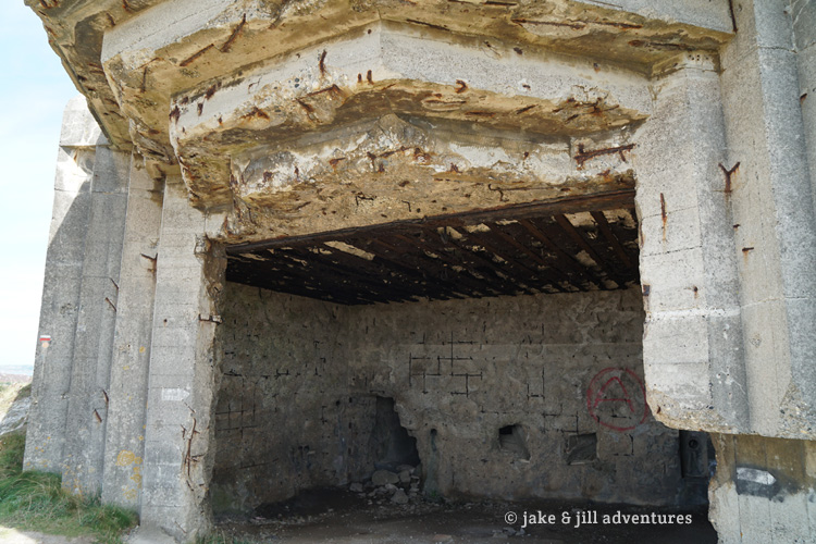
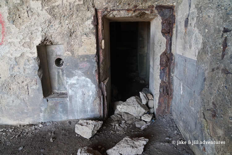
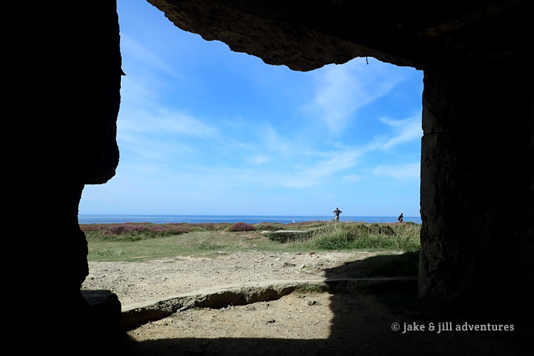
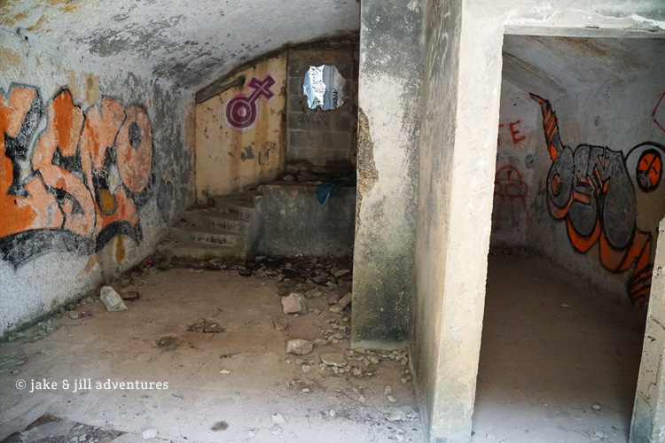
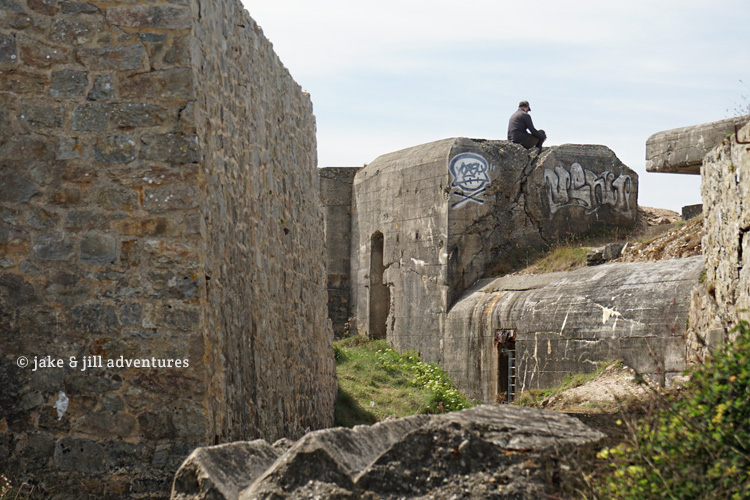
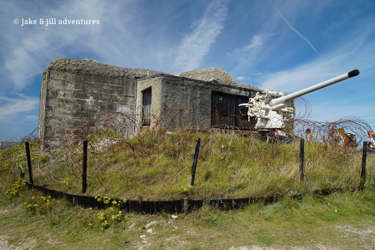
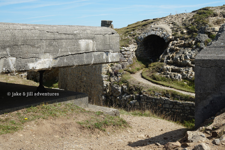
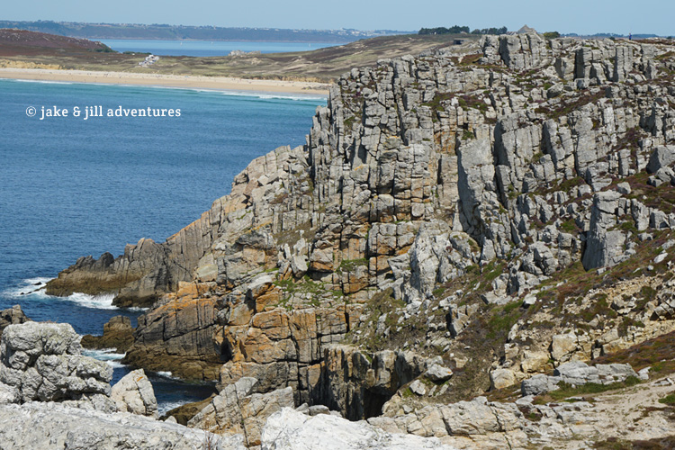
This area is part of the GR34 which is a famous walking path (hiking trail). I can see why its so popular, because this is absolutely gorgeous (assuming the weather is good). We continued along the coast for a bit until we saw a random outcropping of stone structures and large wrought-iron sculptures in the shape of anchors. Jake pulled off the road into a dusty clearing and we walking up the rocky path. We have entered an old bunker from the age of the French Revolution; with water-mines, gigantic iron anchors and propellers, stone trenches of all sizes and shapes. Jake was thrilled, like a kid at Disney Land, climbing into every nook and cranny that he could. The design of the bunker is ingenious. I can see how strategically it would be very difficult to attack by sea, and easy to defend against. Though on a beautiful day like today, its hard to imagine such warfare with the 180 degrees of perfection.
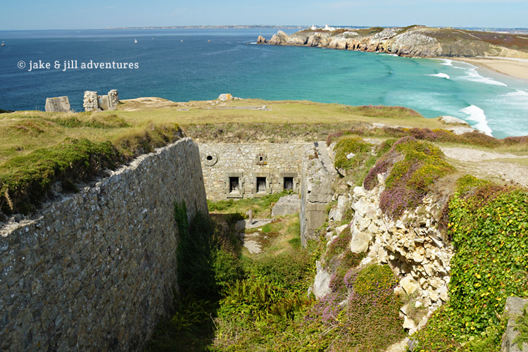
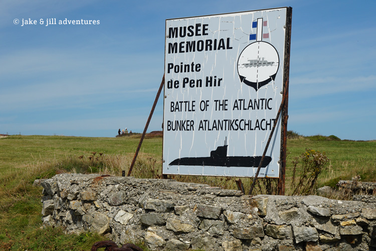
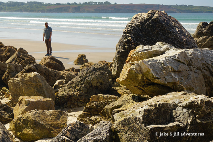
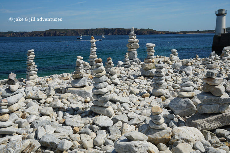
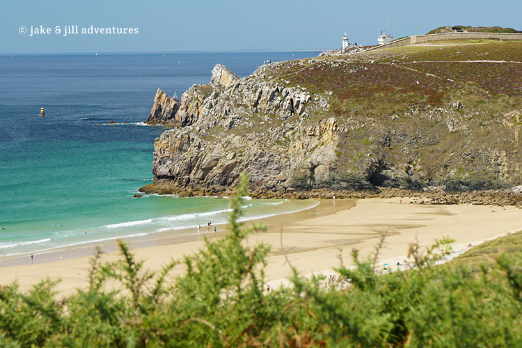
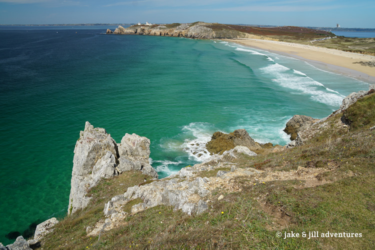
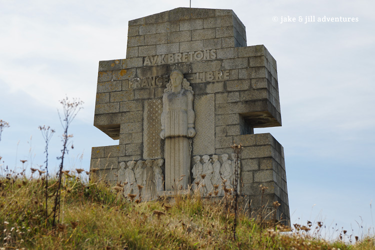
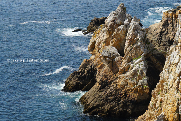
Not far ahead is Pointe de Pen-Hir and unique limestone rocks; ‘Tas de Pois’ (Pile of Peas). The Monument to the Bretons of Free France, known as the Cross of Pen-Hir stands at the edge of the cliff overlooking the sea below. It reminds me of Scotland’s coastal highlands.
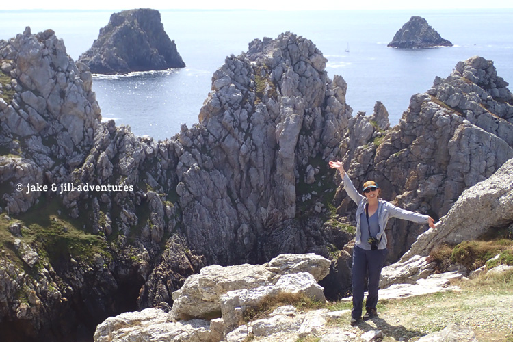
We followed the footpath to some of the lookouts and noticed a pair of rock climbers on one of the features out over the water…now that would be Fun. We couldn’t figure how they managed to get out to the seemingly untethered rock face, but then we spotted a hidden path down below that crossed to the back of the face. While its a very intriguing concept to us rock-climbing nutts, it doesn’t seem like the effort would be worth it for such a short climb…the view from down there isn’t nearly as great as the one from up here. Still, its so fun to see adventurers in action.
I didn’t realize how late it was until my stomach was audibly grumbling and we noticed how low the sun sat in the sky. We have completely missed lunch and are feeling pangs of exhaustion. Right then and there we went back to the car to eat our Parisian lunch of homemade bread, sausage, cheese, brownies and sparkling water.
It was a day full of surprises. We didn’t hit every one of our planned sights, but the ones that we did see were beyond anything we imagined.


Its pretty cool to see something that marked such a significant time in history, and to see it so well in-tact. Thanks for sharing.
Thanks, Kati!