


Cruising & Navigation
Going from point A to point B isn’t rocket science (unless you’re going into space). As long as you know where you want to go and are pointed in the right direction, then all is well. But cruising on a sailboat and specifically sailing from place to place is a bit more involved. Its almost impossible to sail in a straight line from point A to point B (the world is round after all). Longer distances are especially challenging. There are also a lot of rules to think about too (think drivers ed). Knowing rules really helps one navigate safely on the water. Its amazing how many crazy people out here have absolutely NO idea what those rules are…uhem power boaters…
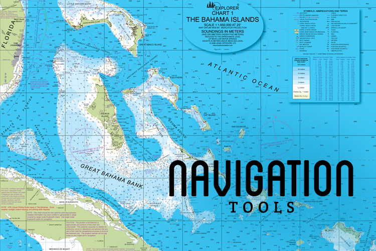
Basic navigation tools begin with charts. Nautical paper charts are pretty different than road maps. There are about a million little icons, markers, numbers, etc that all represent something (buoys, tides, current, channels, depths, hazards, shoals, etc). Learning how to read these charts is pivotal. Once you know your way around the paper chart, electronic charts are a BREEZE!
I won’t speak for every person who aspires to be a cruiser, but if you do, we recommend shortening the learning curve and taking a sailing class. Jake and I took ASA 101, 103 and 104 courses before diving in deep with this whole sailing thing. We also learned all about nautical paper charts and passage making. Ultimately, its the only backup when electronics fail (which will happen). And having backup options is a must!
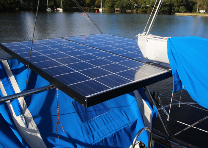
Bosco is equipped with several navigation tools that have and will continue to aid us in our travels to the Bahamas, Caribbean and Virgin Islands (and beyond!):
iPad with GPS
It might sound silly but we LOVE using the iPad as one of our primary navigation tools; namely for GPS and route-planning. Its important that the device be unlocked so that GPS will work with or without WIFI. Otherwise it kind of defeats the purpose. Don’t forget about a waterproof case for this, since it could be exposed to weather.
The main downfall of the iPad is the power-draw. We have a nice sturdy cover that can get wet and take a beating, but also makes it harder to see the screen. We have to turn up the max-brightness, which drains power even faster. Its not terrible for shorter hops, but not for any longer trek. At least, not by itself.
Garmin Mobile Blue Charts with Active Captain
The iPad would be worthless without this amazing Blue Chart App. The system is overlaid with Active Captain. If you’ve never heard of this, get online and start googling. Here I’ll help you [click here]. Blue Charts gives you all the nautical maps you could need of the world for a flat (and very inexpensive) fee. Active Captain is the interactive “guidebook” for the Blue Chart App. And its FREE!!!
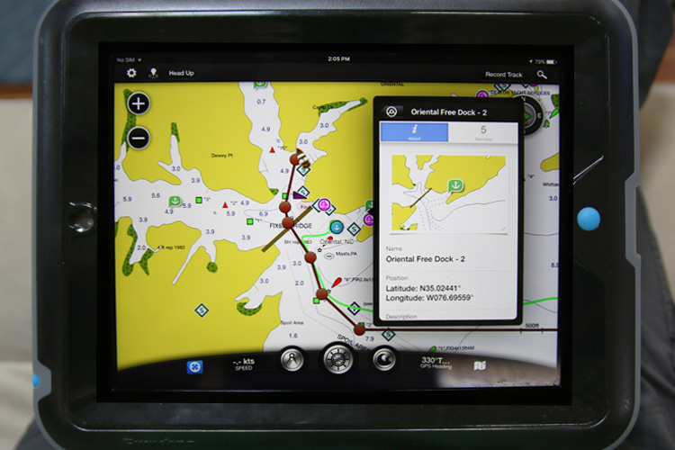
This App almost replaces cruising guides of old. We can easily set routes in minutes, record every move we make, read reviews of hazards, anchorages and even get up-to-the-minute weather updates. For “today’s cruiser,” it would be crazy to NOT have this as a primary navigation tool.
Garmin 440 GPS
The best solution we’ve found is to pair our iPad with the boat’s built-in Garmin GPS chart plotter, which is the Garmin 440 GPS. It even came with preloaded charts of the entire East Coast and the Bahamas all the way to Puerto Rico.
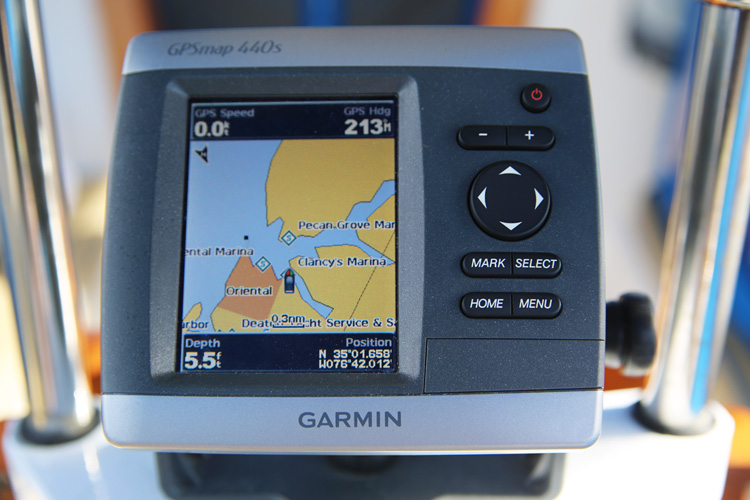
We use the Garmin GPS to plot waypoints (which are the in-between points on the planned route). The GPS is built into the boat’s 12-Volt system, so it doesn’t run out of power the way the iPad does. So we end up using this GPS for the bulk of a journey, and only periodically check progress with the iPad.
Paper Charts
At some point, we are sure that we will lose all power (i.e. battery power). And even if we don’t, we want to be prepared, so we carry detailed (waterproof) nautical paper charts. And paper charts are great, other than their general bulk and awkwardness to use out in the cockpit while underway. They can be difficult to understand and generally need more time and patience to use. Occasionally we practice navigation solely with paper charts just to keep our skills sharpened.
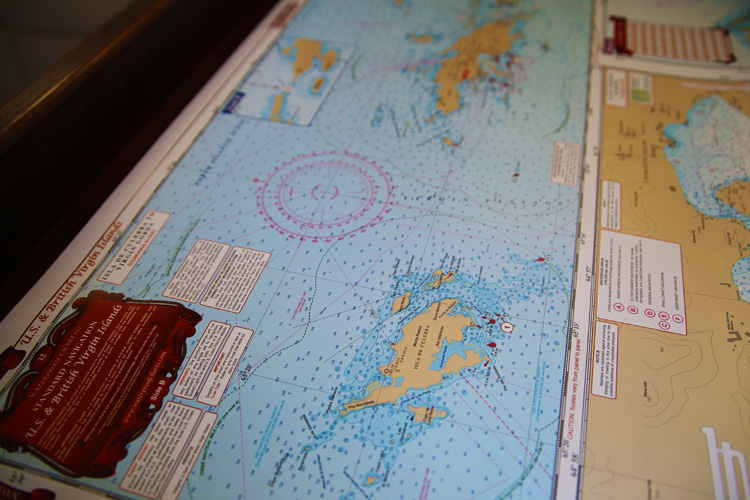
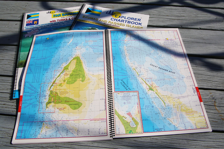
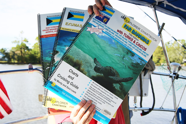
Since Bosco used to live on the Chesapeake Bay, she is stocked with several nav charts in and around that area. We also picked up some ICW chart books before heading down to Oriental. And now we have added to the library with the 3 classic Explorer chart books for the Bahamas, Exumas and Outer Islands & Puerto Rico as well as the large charts of the Virgin Islands. If there are any gaps in our electronic chart systems, we hope that these paper charts will round us out.
Cruising Guidebooks
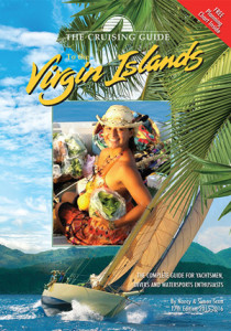 The cruising guidebook used to be the bible when exploring new lands back in the day. Now that Active Captain exists, guidebooks have sort of become obsolete. We still think they will be a fantastic supplement for planning. They are full of great tips, photos, historical information, and suggestions to let you experience everything a place has to offer. We had a few guidebooks for the Chesapeake and ICW, but are most excited about the Virgin Islands Guidebook.
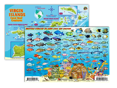 We also found this really cute scuba diving ID card. It shows all of the coral reef fish found in the BVI’s on one side and and a ton of great snorkeling and diving spots on the other. Its made of a plastic waterproof material and handheld, so you can actually take it with while exploring underwater!
Another miscellaneous navigation tool includes the SSB receiver, which we aren’t sure how to use yet. We don’t have radar (I know, god forbid) and will probably hold off getting one installed until we head back north. We also have an old auto helm 3000 that looks like it still works, but we haven’t tested it out in the field yet (fingers crossed there!). All-in-all not a bad selection of useful navigation tools.


Love your blog. These are great tips. My husband and I are headed south this winter as well and are thinking about going to the BVI’s around mid-february. We didn’t realize that there was a separate map for the area (since the Bahamas only goes to Puerto Rico). Maybe we’ll meet in passing. Safe travels.
Carol & John
Wonderful! we hope to cross paths as well. Good luck on your voyage!